The Bottom Master Plan
Dallas, Texas
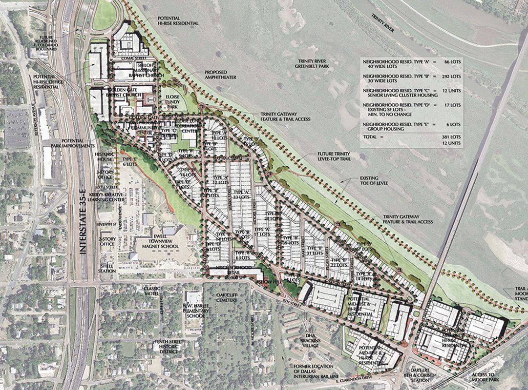
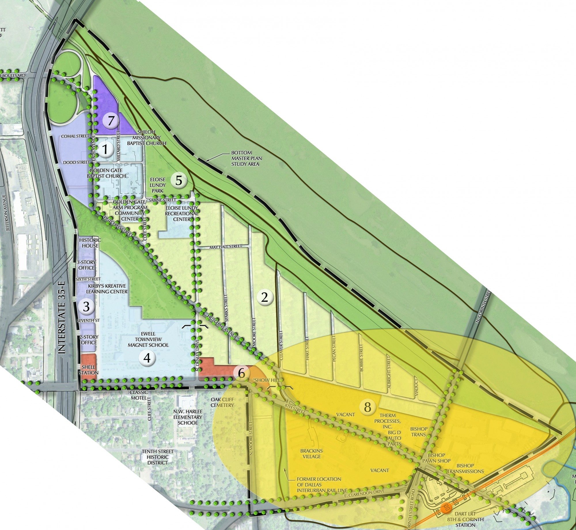
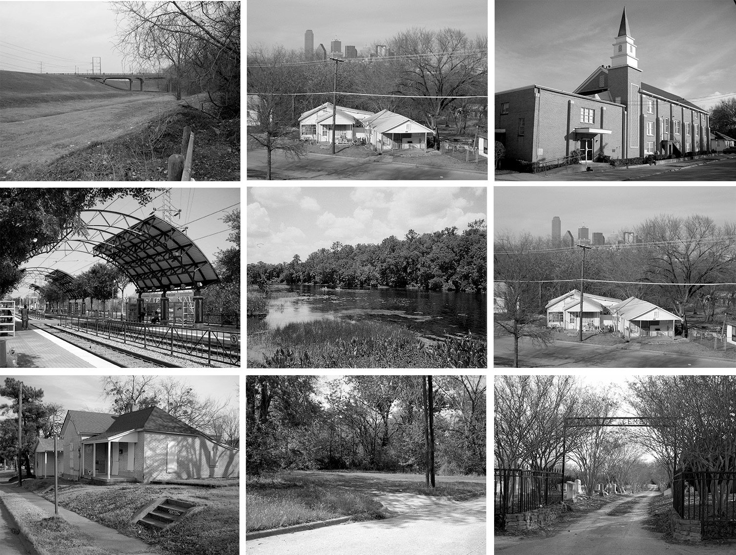
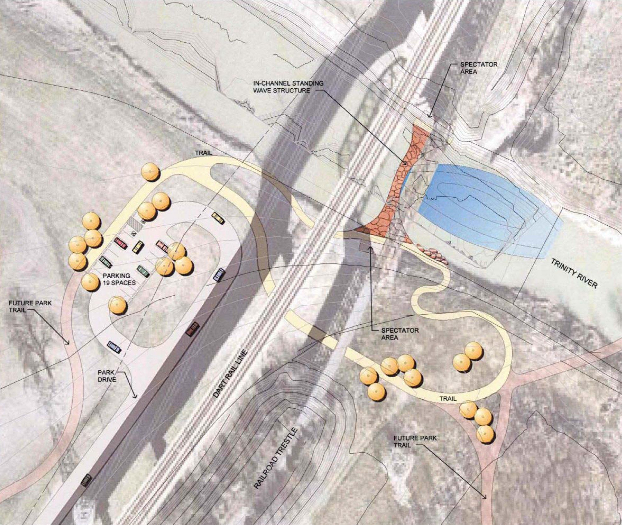
The Bottom is one of the 23 primary study areas that made up the City of Dallas’ Trinity River Corridor Comprehensive Land Use Plan in 2002. This historic area adjacent to one of the City’s three former Freedman’s towns frequently flooded before construction of the Trinity River Levee system. The site’s 90-acre master plan seeks to stabilize the existing residential neighborhood while putting in place design parameters that help to influence future development—some of which may not be compatible with or sensitive to the area’s historic and cultural context. This master plan and it’s corresponding development guidelines will serve as a framework for the City’s Trinity River Corridor Office as it begins to rezone the property in anticipation for both the Bottom’s and Trinity River Project’s vital role as a new “front yard” for the City.